

Support CleanTechnica’s work through a Substack subscription, on Patreon, or on Stripe. Help us produce all of the high-quality, original content we publish week after week despite the challenges of content-scraping AI, antisocial media, inflation, and other hurdles.
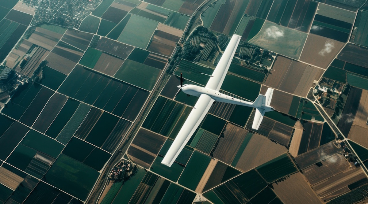
SolarAnywhere® is often associated with utility-scale or distributed PV, but our solar irradiance data powers a lot more than solar plants. A great example: Piotr Lichota at the Warsaw University of Technology is using SolarAnywhere to figure out when to launch solar-assisted Unmanned Aerial Vehicles (UAVs), and how long they can realistically stay in the air.
Solar UAVs are being developed for autonomous environmental monitoring, precision agriculture and search-and-rescue. The success of this technology, however, depends heavily on weather. Weather unpredictability, such as dynamic low-altitude cloud cover in regions like Central Europe, can greatly limit their potential applications.
Modeling UAV flight duration probabilities using SolarAnywhere
To realistically assess whether a UAV can successfully complete a mission, Piotr realized he must find a way to precisely replicate real-world atmospheric volatility. To move past theoretical clear-sky assumptions, he built a simulation framework on top of the SolarAnywhere 25+ year, satellite-derived irradiance dataset.
The process uses Maximum Likelihood Estimation to identify clear-sky DNI and DHI profiles. These profiles demonstrate significantly lower errors than the standard reference, long-term averages or typical meteorological year formulations. The high-fidelity datasets were further used to build a cloud cover model, as default clear-sky assumptions were found to be inherently insufficient in regions characterized by high weather variability, such as those in Central Europe.
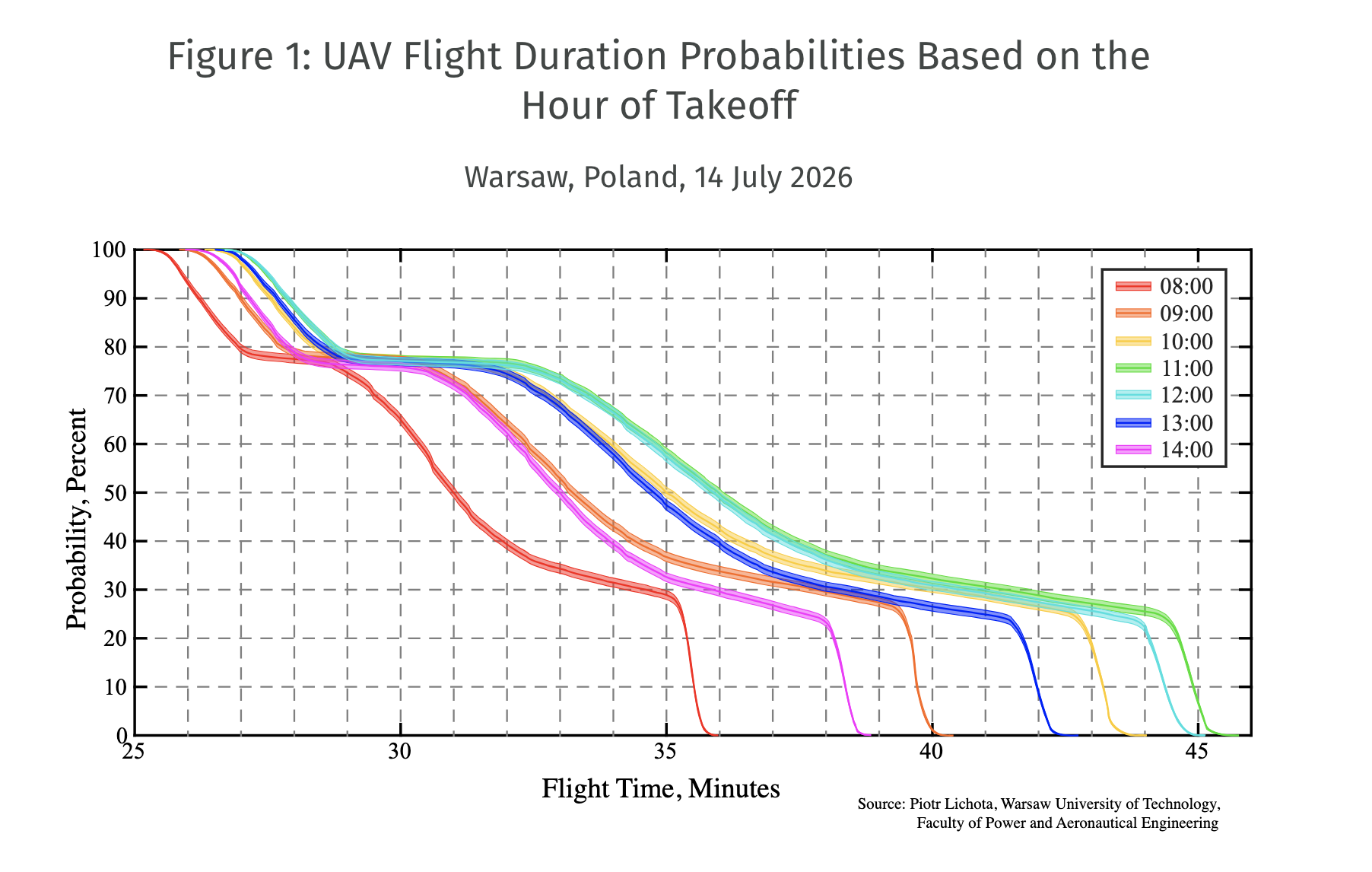
With this stochastic framework, Piotr quantified the probability of achieving a target flight duration for a given time, location and flight configuration. As shown in Figure 1, a midday launch has meaningfully better odds of a longer mission than an early-morning one—same UAV, same day. That’s the kind of insight you can’t get from a clear-sky assumption.
Enabling next-generation green technology
Using this method, Piotr was able to demonstrate how mission feasibility can be impacted by adjustments in solar-to-wing area ratios, battery capacities or the selection of a specific takeoff hour. Instead of estimating an unrealistic theoretical maximum flight duration under a clear sky, the model generated probability curves of mission success. Thus, the framework facilitates the transition towards risk-oriented design for green technology applications.
This use of SolarAnywhere is a great reminder that finance-grade solar resource data isn’t just for solar developers—it can help design the next generation of green technology, in the sky as well as on the ground.
We thank Piotr Lichota at the Warsaw University of Technology, Faculty of Power and Aeronautical Engineering for the collaboration.
This research was funded in whole or in part by National Science Centre, Poland, 2025/09/X/ST8/00294.
News from SolarAnywhere.
Sign up for CleanTechnica’s Weekly Substack for Zach and Scott’s in-depth analyses and high level summaries, sign up for our daily newsletter, and follow us on Google News!
Have a tip for CleanTechnica? Want to advertise? Want to suggest a guest for our CleanTech Talk podcast? Contact us here.
Sign up for our daily newsletter for 15 new cleantech stories a day. Or sign up for our weekly one on top stories of the week if daily is too frequent.

CleanTechnica uses affiliate links. See our policy here.
CleanTechnica’s Comment Policy